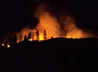
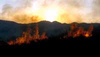
An Initial Burn Severity Map of the 2014 Carlton Complex Wildfires
The fires started on July 14 and continued into late August, so this map does not show the entire extent of the fire, but it does show over 97% of the burn area, as very little area burned before July 15 or after July 31. The map is hosted on ESRI's ArcGIS Online web mapping service and the analysis was done with ArcMap which was donated to PBI by ESRI. The analysis is based on the difference in a vegetation index calculated before and after the fire. The areas with the largest difference in vegetation index are classed as the most severely burned areas. We mapped the fire area into 5 classes. We divided the fire area was into 4 sections to comply with ESRI's 1000 polygon limit for ArcGIS online uploaded features. An artificial line divides these sections. You can change the base map to detailed aerial photography or other base maps, look at the legend and zoom into the details of any area. The last paragraph below describes the methods used for making this map.
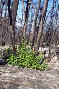
The Burn Area Emergency Response team will also be producing a burn severity map using similar satellite imagery and lots of field assessments of the fire area. Their map is designed to show the effects of the fire on soil conditions - so it differs from the map we produced that shows the effects on live vegetation. In many places the maps are somewhat similar. However, you may find that PBI's map is useful if you are interested in the effect of the fire on live vegetation. We are also very interested in getting feedback about the accuracy of the map, so we invite people to contact us with their direct experience of burn severity or any questions you have.
The following methods were use to make the above map:
1) we downloaded Landsat 8 satellite imagery (11 band imagery) for July 15 and July 31 from NASA
2) we made a composite image of the multiple bands
3) we examined the imagery and determined it had some deficiencies but was adequate for an initial analysis of burn severity.
4) we calculated the Normalized Difference Vegetation Index (NDVI) values for each image ((Band4-Band5) / (Band4+Band5)).
5) we subtracted the NDVI values derived from the July 31 image from the NDVI values derived from July 15 image to obtain a measure of the change in photosynthetically active vegetation as a result of the fire.
6) we calculated an equal area slice of the resulting difference values to obtain 5 relatively equal classes of change in photosynthetically active vegetation - a measure of burn severity,
7) we smoothed this to generalize the result with a moving focal mean statistical function using a 10 cell circular area function
8) we converted the resulting raster to a polygons and eliminated small polygons
9) we converted the polygons to a shapefile and uploaded into an ArcGIS online web map.
10) we used ESRI's ArcMap software to conduct this analysis
Copyright © 2009 Pacific Biodiversity Institute
PO Box 298, 517 Lufkin Lane
Winthrop, WA 98862 509-996-2490