Services of Pacific Biodiversity Institute
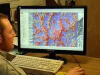
GIS, Remote Sensing, and Mapping
Pacific Biodiversity Institute offers a broad range of state-of-the-art mapping capabilities including the following:
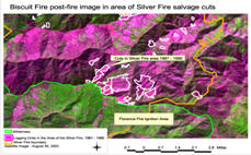
- Landscape Analysis
- Vegetation Community Modeling and Mapping
- Habitat Suitability Modeling and Mapping
- Future Scenarios Modeling and Mapping
- Customized Environmental Mapping
Copyright © Pacific Biodiversity Institute
PO Box 298, 517 Lufkin Lane
Winthrop, WA 98862 509-996-2490