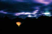
BREAKING NEWS: ANALYSIS AND COMMENTS ON THE YARNELL HILL FIRE IN ARIZONA AND THE CURRENT FIRE SITUATION IN THE USA
2013 July 17
Read or download the entire report here.
Executive Summary and Key Findings and Recommendations
Pacific Biodiversity Institute undertook a rapid analysis of the 2013 Yarnell Hill Fire and the national wildfire situation to help clear up some questions and misinformation that have spread about this fire and about wildfires in general in the United States.
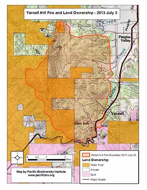
The Yarnell Hill Fire burned in private lands and lands managed by the State of Arizona. Over 68% of the burned area was on private land. About 31% was on State land and less than 1% was on federal BLM land. The land ownership of wildfires occurrences at a national level is similar to that of the Yarnell Hill Fire.
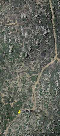
Click on the map below to open a high resolution PDF map of the fire.
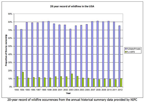
The relationship between fire occurrences and land ownership falls into a consistent pattern year after year. We analyzed the National Interagency Fire Center's (NIFC) historical fire data for the last 20 years (1993 to 2012) (see chart below) and found that on average, 78 percent of wildfire occurrences are on state and private lands compared to 12 percent of National Forest land (U.S. Forest Service). The remaining 10% occur on other federal ownerships and tribal land (BIA). This information is highly relevant to the development of national wildfire policies. From a national wildfire perspective, wildfires on national forest land are much less significant than wildfires on state and private lands.
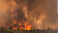
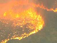
The Yarnell Hill Fire burned through chaparral shrublands. It was not a forest fire. There is a common misperception that wildfires are forest fires. This is typical of the national situation, where many wildfires burn through shrublands and grasslands, not forests. An analysis of the national wildfire situation reveals that most wildfires burn non-forested vegetation, on non-federal land - not forests in the federal domain. These basic facts are often ignored by the media and by politicians when national wildfire policies are debated.
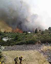
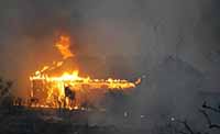
The fact that the Yarnell Hill Fire grew out of control was predictable. The interior chaparral shrublands that it burned through are notorious for high intensity wildfire. There was extreme fire weather during the fire coupled with very dry vegetation as a result of long-term drought, high temperatures, intense sunshine and persistent winds. Unfortunately, it appears that insufficient attention was placed on the critical warning signals of extreme fire weather and fuel conditions, leading to an unfortunate loss of lives.
We have found no evidence that environmentalists discouraged any government agency from thinning and clearing the brush in this area. In fact, no mechanisms exist for environmental groups to comment or interfere with fuel management activities on the private and state land in Arizona.
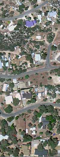
PBI conducted a rapid assessment of homes and other structures inside the southeast perimeter of the Yarnell Hill Fire to determine how many had tree and shrub canopies touching them or overlapping their roofs. We used Google Earth to do that assessment. This analysis gave us a preliminary estimate of the number of potentially fire-safe homes and other major structures. We found that 89% of the homes and other structures appeared to be in direct contact with trees or shrubs.
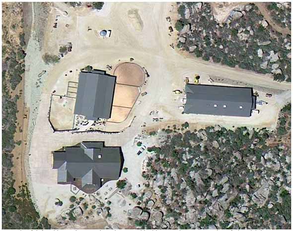
After we conducted the assessment describe above, we obtained preliminary data on the houses that actually burned in the fire. This data was developed by Yavapai County from assessor records and maps. We were able to do a quick comparison of the structures we had marked as potentially fire-safe with the structures that actually burned. We found that 95% of the structures we had marked as potentially fire-safe survived and, at most, 5% burned. This compares very favorably to the 30% of the structures that we had identified as not fire-safe that burned in the fire. The contrast between these two structure survival rates is substantial and illustrates that simple and inexpensive measures, like keeping flammable vegetation away from homes, can have a real impact on the ability of a home to survive a wildfire. We concluded that the residential communities of Glen Ilah and Yarnell were not well prepared for wildfire. It is no surprise that over 100 homes burned. An example of a defensible home and outbuildings that survived the fire is shown below.
Preventing fire tragedies in the future demands fire-adapted communities. Tragedies like the Yarnell Hill Fire are preventable. There are simple things homeowners can do to avoid having fires burn into our communities and homes and to prevent firefighter deaths. The focus of national wildfire policy should shift from fire suppression to fire adaptation, rather than spending billions of dollars every year trying to fight wildfires - often with little success. There should be more effort put into initial attack (when firefighters can be most effective) and firefighters need to stand down once the wildfires get to be very hard to control. A much wiser use of our tax dollars would be to use this money to help homeowners and communities create fire-adapted homes and defensible spaces.
Most importantly, to prevent a tragedy like the 19 deaths that occurred on the Yarnell Hill Fire, citizens and elected officials need to be much more careful about deploying firefighters in extremely hazardous situations where they are risking their lives to protect property. The extreme natural forces involved with many wildfires are often much stronger than anything we have to fight them with. We need to learn not to put young men and women in situations where they have little hope of survival.
Copyright © Pacific Biodiversity Institute
PO Box 298, 517 Lufkin Lane
Winthrop, WA 98862 509-996-2490