Fire Severity Study (continued)
New plots in Libby South Fire Area - October 12, 2001
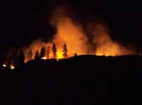
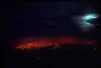
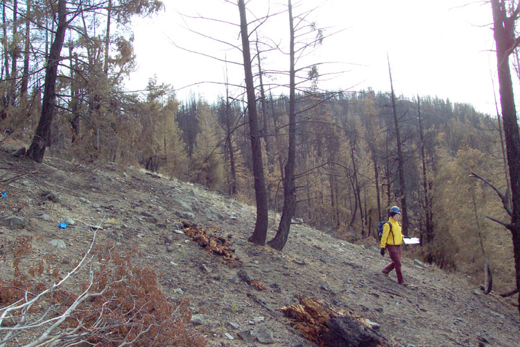
This web page continues studies documented from a survey on October 5, 2001. The point of entry for this fire severity survey was along the east fork of Forest Service Road 43, off of Libby Creek road. We looked at 10 plots in a transect eastwards up to the ridge. The lower elevation plots experienced a mosaic burn of low and medium severity, and the higher elevation plots along the ridge top experienced a high severity burn. The methods used were the same as those in the report from October 5. There is also a web page with results of other fire effects studies done in the Libby South fire on September 27,2001.
Plot Locations
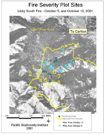 |
| The yellow numbers indicate plots examined in this report |
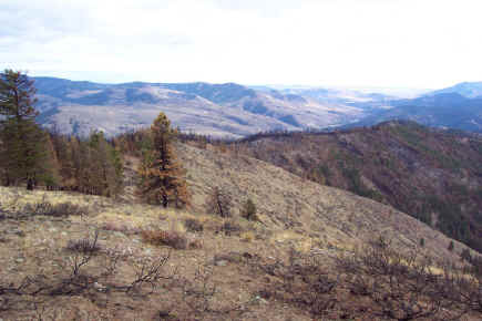 |
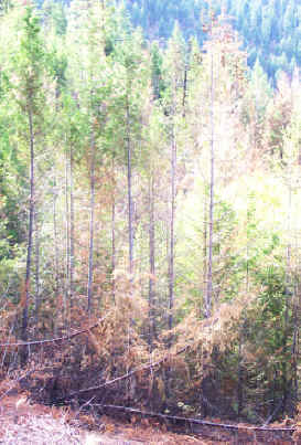
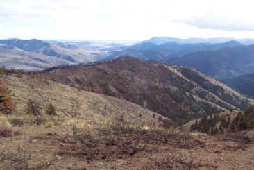
| Looking east across the Libby South burn. The hillside is covered with a mosaic of brown and green trees. |
Results
Plot 1
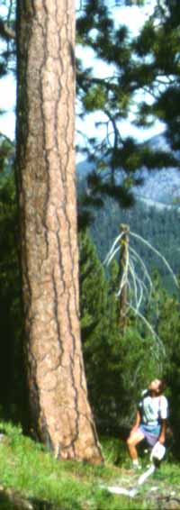
This plot was adjacent to a bulldozed fireline. There were blackened stumps in this area, the remains of past logging operations. There were also stumps of trees that were cut down during fire suppression. All of the trees in the lower canopy layer were scorched. In the intermediate canopy layer, 60% of the needles on the trees were brown, but 80% of those trees still had at least some green on them. 80% of the needles in the upper canopy trees were still green. Char height on the large trees ranged from 1 to 5 meters up the tree trunk. Douglas fir were the only evergreen tree in this plot, and they created about 50% canopy cover in the plot.
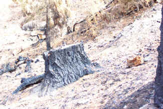 |
| Stump of a tree that was cut down before the Libby South fire burned. This area of the Okanogan National Forest has a history of logging. |
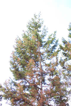 |
| A Douglas-fir tree whose needles are about 50% scorched (brown) and 50% green. The green needles increase the probability of its survival |
Plot 2
This plot is in an area that has experienced past forest management. It had blackened stumps from trees that were cut down before the fire. Interestingly, a dense stands of small diameter trees in this plot did not burn. The rest of the plot demonstrated a mixed severity burn. While one large ponderosa pine tree was torched to the top, another Douglas-fir of similar size, only 20 meters away, was mostly green. Overall, 70% of the needles in the upper canopy of trees were green, 20% were brown, and 10% were black. All of the upper canopy trees still had green needles.
 |
| This plot had a mixture of green, brown, and torched black trees. |
 |
| This dense stand of small-diameter trees did not burn. |
Plot 3
This plot was composed of a lower canopy of Douglas-fir trees under 2 meters and an upper canopy of Douglas-fir trees under 10 meters tall. The needles on the trees in the lower canopy were 70% black and those in the upper canopy were 30% black, 40% brown, and 30% green. The ground and its litter was 90% blackened.
 |
| Most of the trees on the steep slopes of this plot had blackened trunks with brown or black needles. |
 |
| The gnarly black branches of these Douglas-fir trees appear to have been affected by mistletoe. |
Plot 4
This plot was mostly open, but with a lower canopy of trees under 3 meters, an intermediate canopy, and one large tree over 15 meters tall. 60% of the needles in the lower canopy were brown, and 65% of the needles in the intermediate canopy were brown, with 80% of those trees still having some green on them. 80% of the needles on the large tree were still green.
 |
Plot 5
This plot consisted of a lower canopy with trees less than 1 meter in height, and an intermediate canopy with trees less than 10 meters. Herbs and low shrubs in the area were 60% black, but the lower canopy of trees was 80% green, and the upper canopy was 70% green.
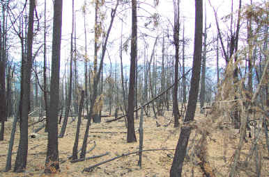
Plot 6
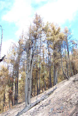
This plot was located on the ridgeline. The litter and substrate were completely black, the needles on the lower canopy of Douglas-fir trees were 80% brown, and the upper canopy of trees below 10 meters were 80% black.
 |
| A stand-replacing intensity fire burned along the ridgeline. |
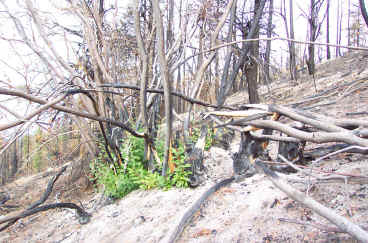 |
| Regrowth of a shrub. |
Plot 7
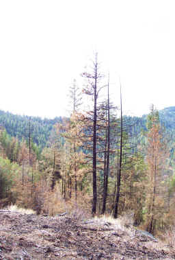
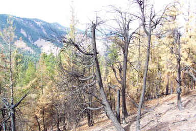
All of the trees in this plot were either completely torched or had a few brown needles. The trees in the plot were Douglas-fir and covered only about 30% of the plot area.
|
| A stand-replacing intensity fire burned along the ridgeline. |
|
| Regrowth of a shrub. |
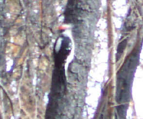 |
| A hairy woodpecker busy at work in the black Douglas-fir trees along the ridgeline. Life is continuing in this seemingly 'dead' forest. |
Plot 8
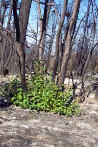
A high-intensity, stand-replacing fire burned through this area and all of the trees and shrubs have been completely blackened. However, shrubs are beginning to resprout and deer tracks and rabbit droppings indicate that life is continuing in the forest.
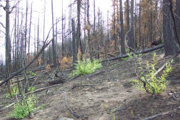 |
| Black trees and resprouting trees and shrubs. |
 |
| Black trees and resprouting trees and shrubs. |
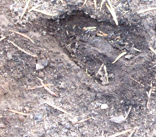 |
| A deer track in the blackened soil. |
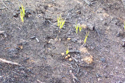 |
| Resprouting grass, a deer track (center) and rabbit droppings. |
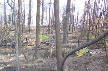
Plot 9
The trees in this plot were completely black. The soil and low shrubs were also black.
 |
| Black trees and brown needles on the forest floor that fell after the fire |
 |
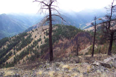
| Looking east over the Libby South burn shows the mosaic of brown and green trees. This lovely vista demonstrates that areas burned over in wildfires are not necessarily ugly. |
 |
| Looking south over the Libby South burn area. The sharp line between burnt and un-burnt forest is probably the product of suppression efforts by firefighters. |
Plot 10
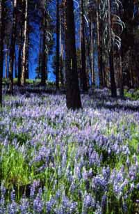
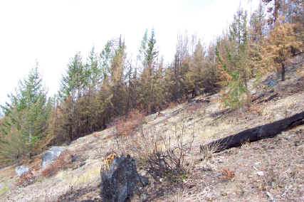
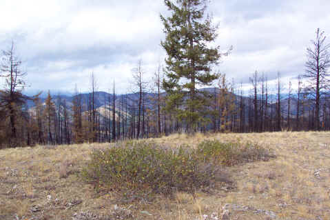
This plot is at the highest elevation in the Libby South burn area. Despite being surrounded by forests that have been severely burned this area is unburned. Grass covers about 80% of the plot, mixed with bitterbrush, ceanothus and a few Douglas-fir trees.
 |
| Unburned grassy meadow surrounded by a blackened forest. |
Copyright © 2009 Pacific Biodiversity Institute
PO Box 298, 517 Lufkin Lane
Winthrop, WA 98862 509-996-2490