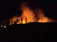
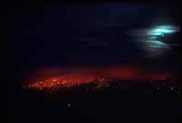
Fire Severity Study
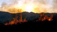
Libby South Fire Area - October 5, 2001
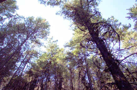
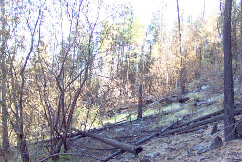
These photos were taken October 5, 2001, nearly three months after the Libby South Fire started near Libby Creek within the Okanogan National Forest. The photos document plots assessed for fire severity and the effects of the fire on the ecosystem. Fire severity varied greatly in this area, but in all sections of the burned forest and shrublands regrowth was apparent.
This study is continued on another web page containing results from a second survey on October 12, 2001. There is also a web page with results of other fire effects studies done in the Libby South fire area on September 27,2001.
 |
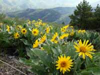
| Resprouting willows (Salix sp.) showing recent browsing by deer. |
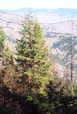 |
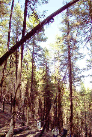
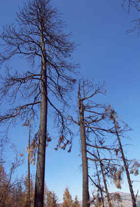
| Inside the burn area, looking north into Libby Creek. Some trees in the foreground have been browned by the fire, but almost all trees in this area still have some green parts, increasing the likelihood that they will survive. |
Methods
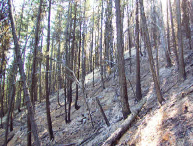
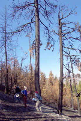
On October 5, 2001, we walked through the northern portion of the burn site and chose plots to do a detailed analysis of burn severity. We determined plots to have a 30-meter radius. Each plot characterized the surrounding section of forest that was relatively homogeneous in burn severity. We took GPS waypoints at the center of each plot.
We rated burned severity based on a burn severity matrix created by the USGS (The Composite Burn Index (CBI): Field Rating of Burn Severity. NRMSC Research. USGS.). We simplified the USGS methods, in order to focus only on trees affected by fire. Instead of classifying the vegetation by height, we divided the forest canopy in each plot into lower canopy, intermediate canopy, and upper canopy. Some plots were homogenous and did not have lower and intermediate canopy levels. Instead of classifying burn severity into low, medium and high, we determined the percent of each canopy type that was brown, green and black. We also determined the percentage of trees in each canopy layer that still had some green needles, indicating a high probability of survival.
Locations of plots in the area are shown in the next image.

The above scan shows an areal view of the Libby South area forests prior to the fire. The points show the locations of plots described in this report.
Results
Plot 1
The terrain in this plot is very steep. Sixty percent of the trees in the plot are Douglas-fir and 40% are ponderosa pine. The upper canopy consists of trees greater than 15 cm in diameter, and of these 70% of the needles are brown. However, 90% of the trees still have some green on them, indicating possible tree survival. The mid-story of the canopy consists of trees between 10 and 15 cm in diameter. Of these, 95% of the needles are brown, while about 70% of the trees still have some green on them. Only 10% of the lower canopy layer (trees and saplings less than 5 cm) still has green needles. Ninety-five percent of the litter on the forest floor had burned.
 |
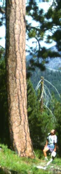
| Green needles at the top of the forest canopy. |
 |
| The fire burned through the understory, with char heights only up to a couple of feet on the intermediate sized-trees. |
 |
| Burnt needles and rocks on the forest floor. |
Plot 2
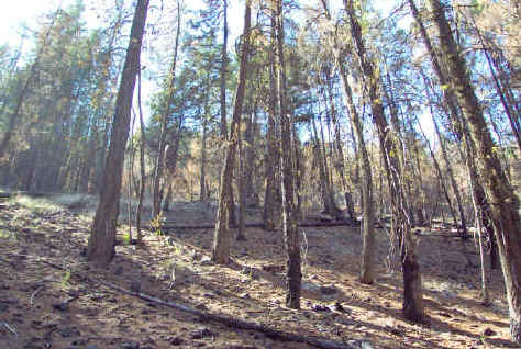
This plot is predominantly Douglas fir, with some ponderosa pine. The trees are of nearly uniform height, and are all between 5 and 15 cm in diameter. 100% of the trees in this area still had some green on them, and only about 10% of the needles on the trees were brown. The trees within this plot were densely stocked with significant ladder-fuels. This site fits the stereotypical description of a forest where the fire would rapidly spread to the tree crowns and kill all the trees. However, the fire here burned only through the understory and char heights were limited to only a few feet.
 |
| The lower branches of the trees in this densely stocked forest are brown or burned, while the needles in the crowns of the trees remain green, indicating probable tree survival. |
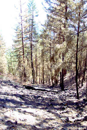
Plot 3
The majority of the trees in this area are Douglas-fir, with some ponderosa pine and an understory of willows. The upper canopy consists of trees 5 to 15 cm in diameter. In the upper canopy, 65% of the needles are brown, but nearly all of the trees have some green on them still, indicating possible tree survival. The lower canopy is nearly completely brown, with only about 5% of the trees with some green on them still.
 |
| Fire burned the lower canopy in this area, as well as the lower branches and needles in the upper canopy. Nearly all of the upper canopy trees still have some green on them. |
 |
| The char height is up to two meters in the upper canopy trees |
Plot 4
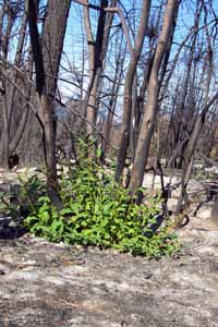
Trees in this area covered only about 60% of the plot. 40% of the area was open. Of the upper canopy of Douglas-fir trees (5-15 cm diameter) about 50% still had some green on them. 10% of the trees were black and were been completely torched. The understory of willows and saplings was completely brown with no green on any of the trees. The burn was patchy in the open areas, and both grasses and small shrubs were beginning to resprout. Many of the young willows show indications of browsing by deer.
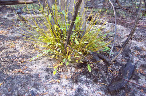 |
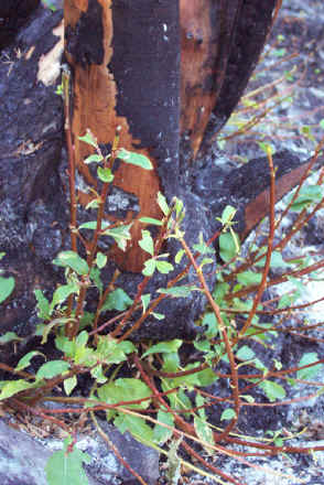
| This willow tree (Salix sp.) resprouted after the burn, and deer apparently have already eaten off many of the young leaves. |
 |
| The fire burned litter and debris on the grounds, as well as some willow trees and Douglas-fir trees. Some patches were unaffected by fire. |
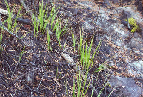 |
| Grass respouting from the ash-covered forest floor. |
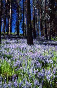
Plot 5
This plot is mostly open, with only about 10% of the area covered by a Douglas-fir canopy. The area was only lightly burned, with about 10% of the litter burned. Ninety percent of the small Douglas-fir saplings are still green and all of the larger Douglas-fir trees had at least some green on them.
 |
| Unburned grass characterizes this site, and the trees in the plot are still green. |
Plot 6
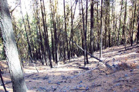
The trees in this plot consist of medium-sized trees (5-15cm diameter) in the lower canopy and large trees ( greater than 20% diameter) in the upper canopy. Fire severity was high in this area, and 90% of the trees in the lower canopy are completely black ('torched'). Eighty percent of the trees in the upper canopy are completely black with no green left on the trees. This is a relatively open area, with the tree canopy formerly covering only about 60% of the plot.
 |
 |
| Torched ponderosa pine trees on the steep, north-east facing side of a ridge. |
In the forest, near Forest Service Road 43, bulldozer tracks and stumps stand as reminders of fire suppression activities. Bulldozers drove up very steep terrain to build fire lines, but blackened trees stood on both sides of those lines, which apparently did not stop the spread of the fire.
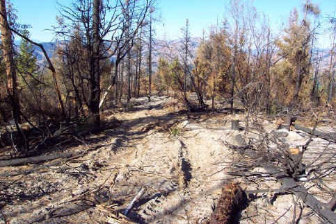 |
| Bulldozer tracks indicating a fireline built for fire suppression. The new road created here apparently did not stop the spread of the fire. |
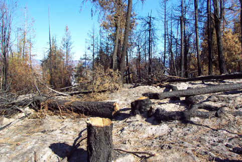 |
| These blackened stumps were probably cut down after they had been burned. Trees are often cut down during fire suppression. |
Copyright © 2009 Pacific Biodiversity Institute
PO Box 298, 517 Lufkin Lane
Winthrop, WA 98862 509-996-2490