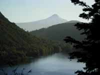
More about the South America Wildlands and Biodiversity Project
This project focuses on mapping and analyzing the roadless/undeveloped areas in the South American continent using a procedure Pacific Biodiversity Institute (PBI) developed to map the wildlands of the USA in 2001. Our goals for this multi-year project are as follows:
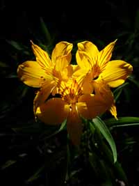
- It will provide baseline data on wildlands and related biodiversity in South America. Much of the information that will be developed in this project does not now exist.
- The project is intended to provide valuable information that informs conservation decisions and increases capability of conservation scientists and conservation NGOs in South America.
- It will stimulate decision-making on conservation issues based on scientific information and well-defined, ecologically meaningful conservation units (wildland areas). A biodiversity-focused decision support system will provide a tool conservationist can use to evaluate biodiversity values and integrate them in local, regional and national conservation decisions.
- The project will identify conservation linkages between neighboring countries, thus offering unique opportunities for collaborative conservation work that transcends beyond national boundaries.
- It will help build the capacity of partner NGOs through training and material support.
- It will provide educational benefits to partner NGOs and build their capacity by raising skills and understanding.
- It will integrate the involvement of volunteers, located both in the USA and in South America, to conduct some of the wildland assessment tasks, using Google Earth, spatial information accessed through ESRI software and on-the-ground assessments.
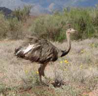
- It will integrate and develop baseline data on the effects of conservation and various forms of development and resource extraction on indigenous peoples.
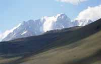
An important part of the project involves visual assessment of wildland areas through aerial photo and satellite image interpretation. In our previous work of this nature, this has been a very difficult task, requiring development of a huge library of remotely-sensed imagery. Today, that has been done for us by Google Earth. We will train volunteers in visual assessment techniques using Google Earth. You can help by joining us and helping assess these wildland complexes by exploring them in Google Earth, digitizing new roads, developments and other features using Google Earth. Many people can assist with the project using fairly simple computers and with only a day of training. Contact us if you are interested. Explore our growing collection of webmaps large wildland complexes in Argentina and Chile.
After we map the wildland areas, we are analyzing a suite of landscape attributes that are indicators of biodiversity and conservation value. These attributes will be used to determine initial conservation priorities within the wildlands of Chile and Argentina. The products will be a series of valuable spatial datasets, a multi-lingual conservation decision support system to determine conservation priorities, a highly readable multi-lingual report, and a multi-lingual website to help disseminate the project results.
This project will provide a base for international collaboration between international, national and local conservation interests. Our past work in mapping and analysis of wildlands in the USA has been useful in stimulating and supporting conservation of some of the most important wild places in this country. The current project will do the same, first in Chile and Argentina, then later throughout the rest of South America.
Join us as a partner in this project
We are actively seeking conservation and science partners for this project. We are working to form a partnership with at least one national conservation group in each country as well as with regional and local groups that have an interest in the conservation of biodiversity and wildlands. We are also working to form partnerships with international conservation organizations which have an interest in the biodiversity and wildlands of South America. In addition to this, we are interested in forming partnerships with scientists and students at universities in South American countries that may be interested in participating in this project.
Our intention is that the local, regional and national conservation NGOs that partner with us in this project will reap the primary rewards of the project. The partner organizations will benefit from a transfer of expertise and technology from PBI. Since we have already engaged in a similar project that covers the entire USA and its territories, we have a lot of experience and expertise to offer others. PBI can help the various partner organizations pull together a continent-wide coalition to achieve the eventual goal of a seamless, continental-scale analysis of wildlands and related biodiversity values. PBI can also help the partner organizations with international fundraising activities that will be needed to make this project a success.
Contact us if you are interested in participating in this exciting project. We need volunteers, donors and a wide variety of resources and expertise to complete the project in a timely fashion. Every day we wait, the precious, wild reservoirs of biodiversity in South America are eroded by encroaching development and resource extraction.
Contact us at the address below for more information on this project.
Copyright © Pacific Biodiversity Institute